The Ruta dels Indiketes will be in a testing period until June 2023, when the official opening will take place.
Collaborate herereporting the errors detected in the route and with any suggestion.
The route
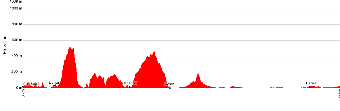
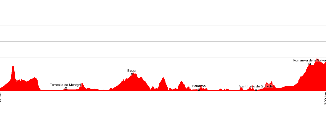
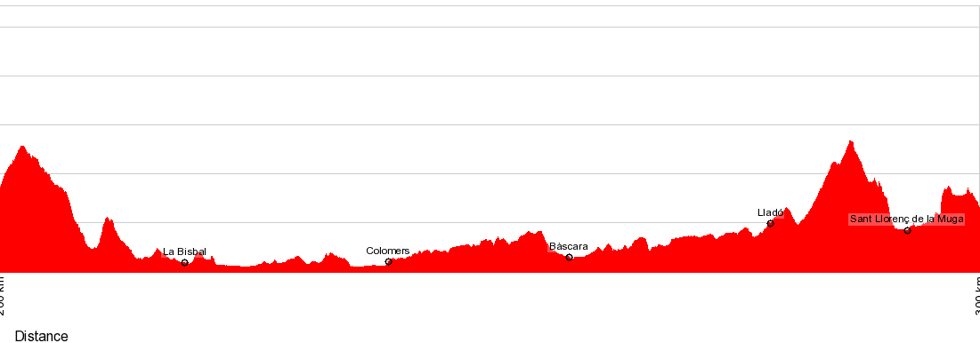
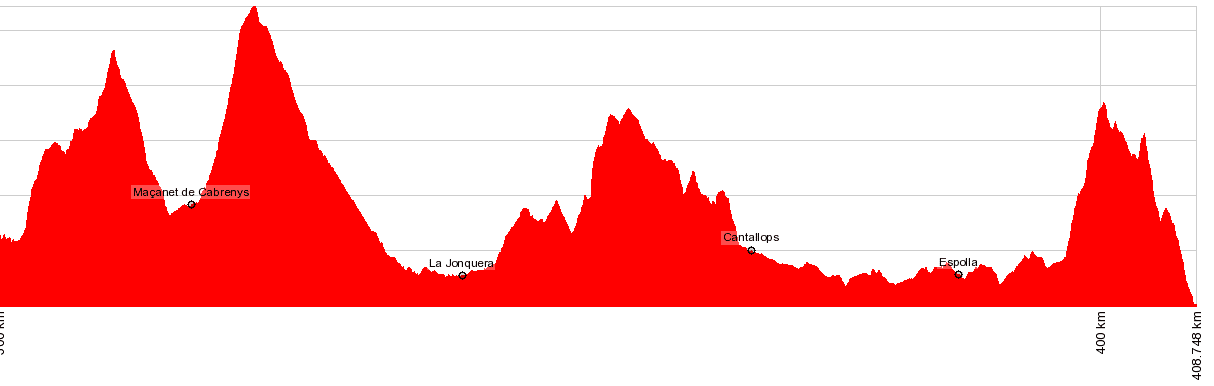
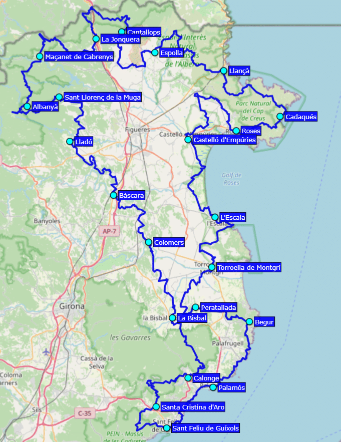
The Route of the Indiketes is the circular tour of the Alt and Baix Empordà in stages, with a route of 476 km that in the coastal area runs mostly along the GR-92 and in the mountainous area along the GR-2, but also they runs trails and unmarked paths that give this itinerary a special character.
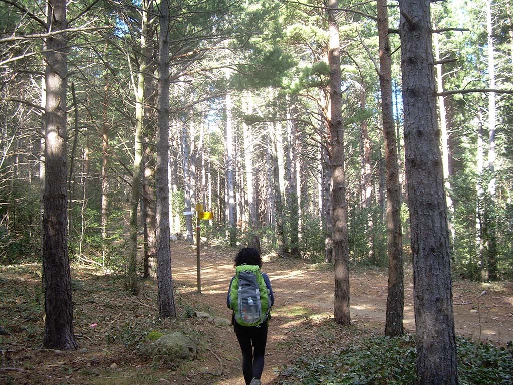
The altimetry of the Empordà is variable: the highest point of the Route of the Indiketes is at 1,084 metres above sea level, in the area of Mare de Déu de les Salines, in the municipality of Maçanet de Cabrenys, and at other mountainous points passes several times over points that exceed 500 metres. On the other hand, in the Empordà plain area, the route passes almost at sea level. And in some parts of the more rugged coastline it runs along narrow, often technical paths, with constant ascents and descents. This variability in altitude and its long distance make the Indiketes Route a hiking challenge that is not accessible to everyone.
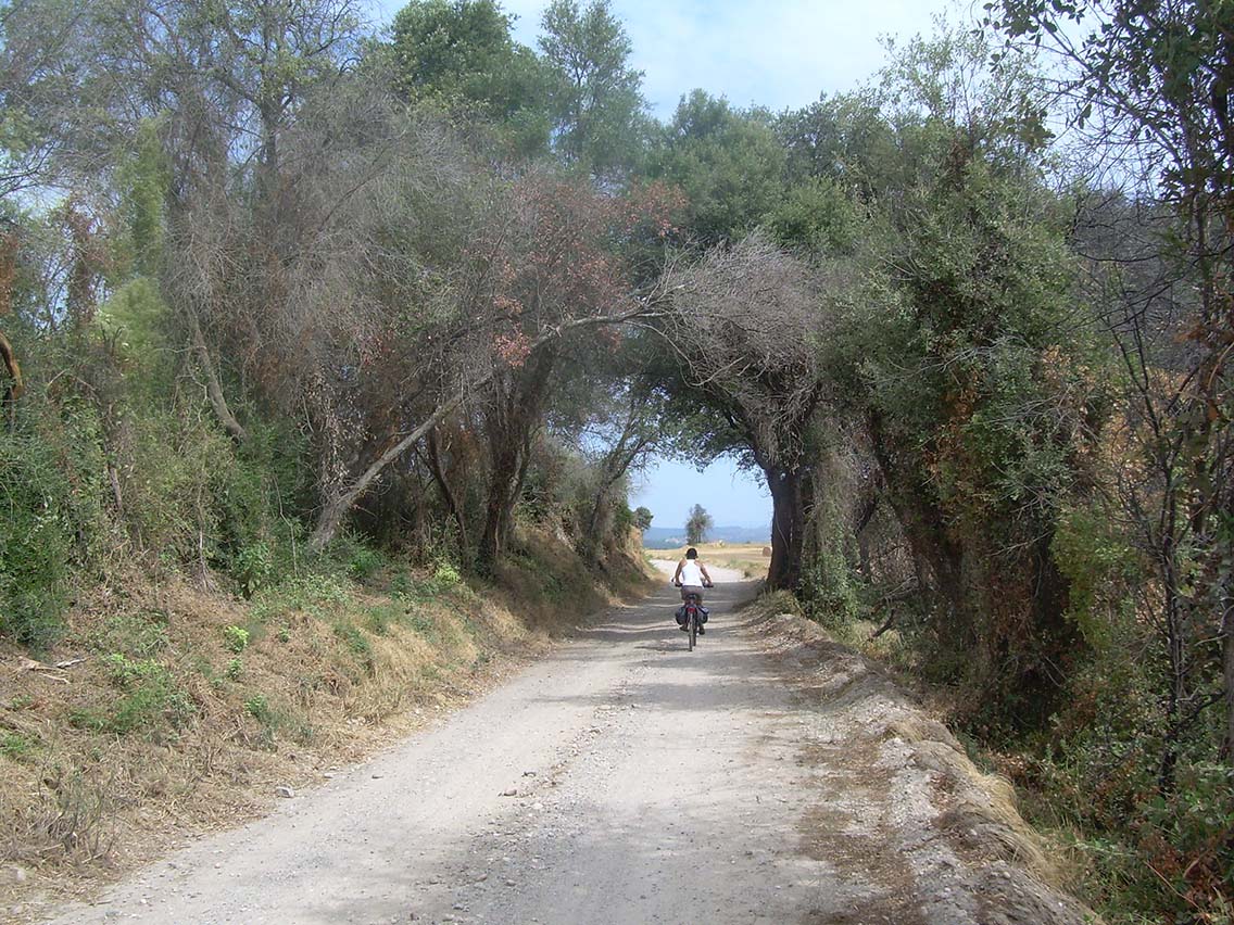
The Ruta dels Indiketes is also a very attractive route for mountain bikers. In some very difficult sections it is advisable to use a different route to the hiking route, but in 90% of the route the route is exactly the same, which is an added incentive for MTB lovers.
Technical specifications
Distance: 476 Km
Cumulative altitude difference: 21,253 m
You can see the 22 stages of the Ruta dels Indiketes in the following link:
This website uses cookies to improve your experience while you navigate through the website. Out of these, the cookies that are categorized as necessary are stored on your browser as they are essential for the working of basic functionalities of the website. We also use third-party cookies that help us analyze and understand how you use this website. These cookies will be stored in your browser only with your consent. You also have the option to opt-out of these cookies. But opting out of some of these cookies may affect your browsing experience.
Necessary cookies are absolutely essential for the website to function properly. These cookies ensure basic functionalities and security features of the website, anonymously.
Cookie
Duración
Descripción
cookielawinfo-checbox-analytics
11 months
This cookie is set by GDPR Cookie Consent plugin. The cookie is used to store the user consent for the cookies in the category "Analytics".
cookielawinfo-checbox-functional
11 months
The cookie is set by GDPR cookie consent to record the user consent for the cookies in the category "Functional".
cookielawinfo-checbox-others
11 months
This cookie is set by GDPR Cookie Consent plugin. The cookie is used to store the user consent for the cookies in the category "Other.
cookielawinfo-checkbox-necessary
11 months
This cookie is set by GDPR Cookie Consent plugin. The cookies is used to store the user consent for the cookies in the category "Necessary".
cookielawinfo-checkbox-performance
11 months
This cookie is set by GDPR Cookie Consent plugin. The cookie is used to store the user consent for the cookies in the category "Performance".
viewed_cookie_policy
11 months
The cookie is set by the GDPR Cookie Consent plugin and is used to store whether or not user has consented to the use of cookies. It does not store any personal data.
Functional cookies help to perform certain functionalities like sharing the content of the website on social media platforms, collect feedbacks, and other third-party features.
Performance cookies are used to understand and analyze the key performance indexes of the website which helps in delivering a better user experience for the visitors.
Analytical cookies are used to understand how visitors interact with the website. These cookies help provide information on metrics the number of visitors, bounce rate, traffic source, etc.
Advertisement cookies are used to provide visitors with relevant ads and marketing campaigns. These cookies track visitors across websites and collect information to provide customised ads.